| 
Robbery Hill el 8937'. Photo by Rick Baugher
| LRR 8'ers
This is not a farce. Before talking about little peaks in a big mountain range, for perspective, know that there are 36 states in the US with highpoints under 8000 feet in elevation.
By an impromptu count there are 18+ eight thousand foot peaks in Idaho's Lost River Range, and while they've now all been climbed, only four have names you can find on a map. Here's a sampling.
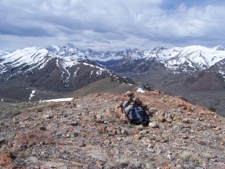
Robbery Hill el 8937' is the highest LRR 8'er. It is located in the Spring Hill segment of the range, and overlooks Doublespring Road. Here's the story on the name. The 1935 advance sheet of the Borah Peak 30' quad has the ranch at the base of this mountain identified as 'Yribar'. This name was later deleted on the official edition of 1938. My take is that Yribar was a poorly spelled anagram for robbery. In the lawless 1880's this section of Pahsimeroi Valley was a known hide out for horse thieves and cattle rustlers.
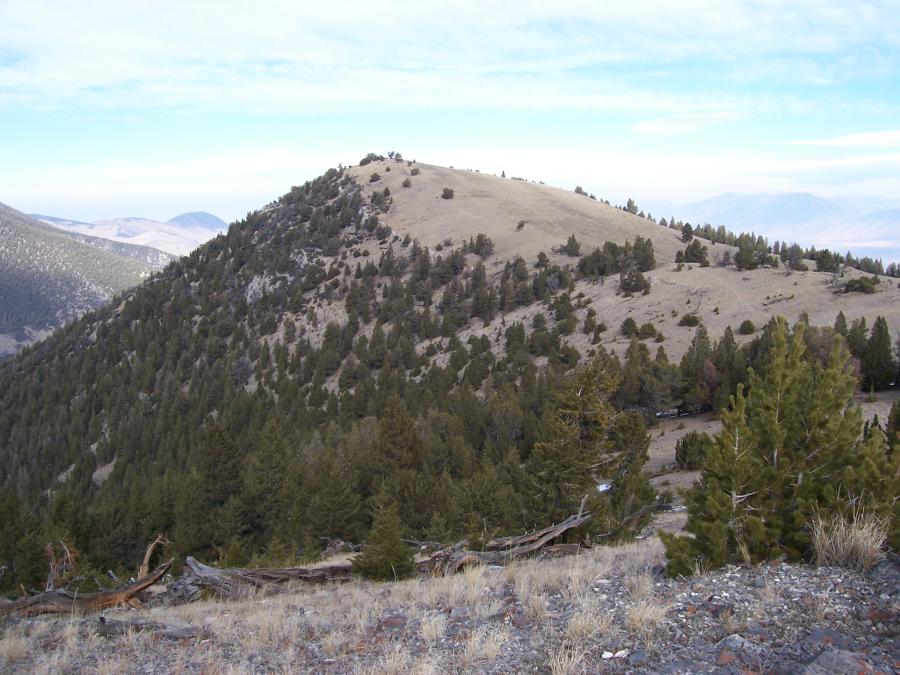
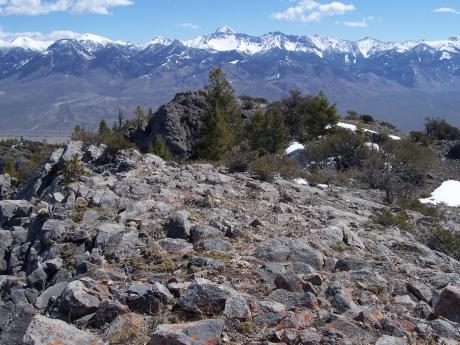
Mahogany Hill el 8441' is officially named, and even has a USGS quad named for it. Yet on 5/30/07 I could find no sign of prior summit visitation. For anyone wishing to climb the LRR 8'ers, encounters with mountain mahogany (Cercocarpus montanus) are almost unavoidable. The namesake spiny shrub/tree forms a dense thicket around this mountain. On the peak's SW side a maze-like opening can be found leading to the top.
|
| 
Mahogany Hill. View S on 5/30/07.. Photo by Rick Baugher.
|
Mahogany Hill rises out of Pahsimeroi Valley. View S on 5/30/07.
|
| 
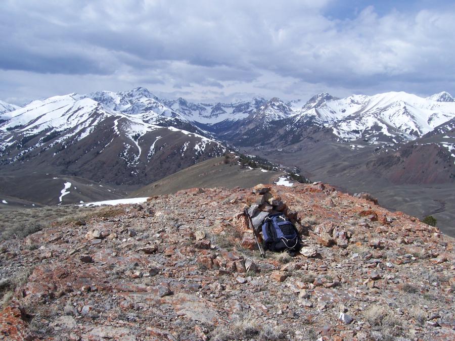
Collapse Point el 8791'. Photo by Rick Baugher.
|
Collapse Point el 8791' overlooks the fork of Long Lost Creek (L), and Dry Creek (R) on the backside of the Lost River Range. Peaks L to R include: Ferguson, Lost River, Breitenbach, Cleft, snowy Apex, and Corruption. Summit photo 4/29/07. In 1956 the Dry Creek dam collapsed, killing one person. From here you get a good view of the collapsed dam and crumbly country rock.
|
| 
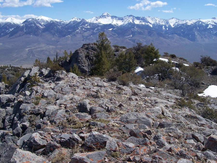
Summit of Little Haw. Photo by Rick Baugher.
|
On 4/22/09 I did a circular route of this mountain. Heading up Hawley Canyon, got well entangled in a one mile stretch of dense mountain mahogany, a place where not even the deer roam. Mid way through this morass, and now pretty well scratched up, came across a 3' diameter sawed Douglas fir stump, cut down over 100 years ago. It's incredible what these pioneers had to do to eke out a living. On top of Little Haw, or Hee Haw to me, for getting suckered into the canyon route, found no sign of previous summit visitation. The 1957 map shows a summit elevation of 8324', while the current 1987 Hawley quad shows a highest enclosed contour of 8280'. Parent is Hawley Mtn 9752', and prominence is near 500'. Dropping down the peak's east ridge, the going was much better. Several low cliff bands were easily passed. At one band found a rusty 1930's tobacco tin. Just imagine this contented hunter, puffing on his pipe, scoping big game, thankful he's not down in Hawley Canyon.
Here's the summit of Little Haw (Hee Haw), composed of cliff forming limestone, Douglas fir, and... mountain mahogany. A 3' cairn was placed on this spot. View NE to Lemhi Range on 4/22/09. Peaks L to R: Amy's, Lexi's, Brow, Diamond, Riddler, Big Boy, Shoshone John, and Nicholson on extreme right.
If it's an 8, don't wait
Rick Baugher
April 24, 2009
|
|