Scout
your next climb in Idaho
|
Scout
your next climb in Idaho
|
|
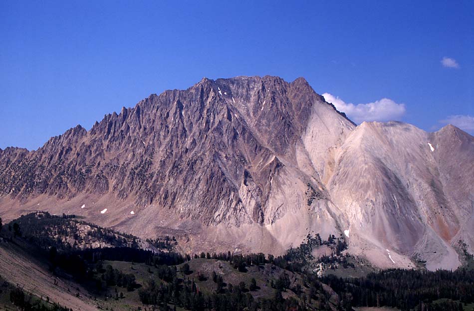
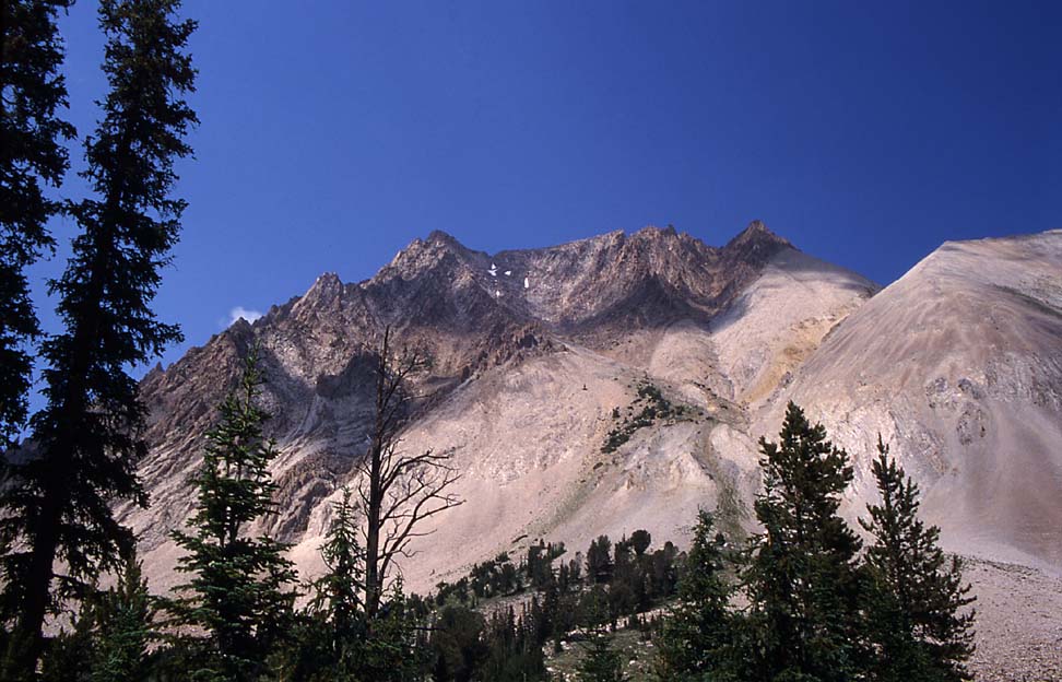
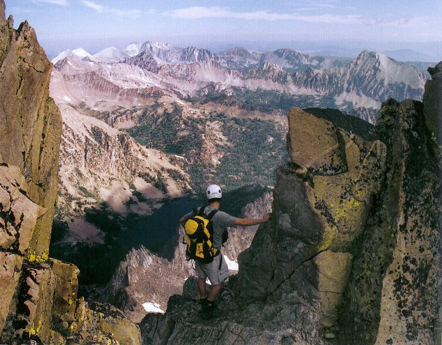
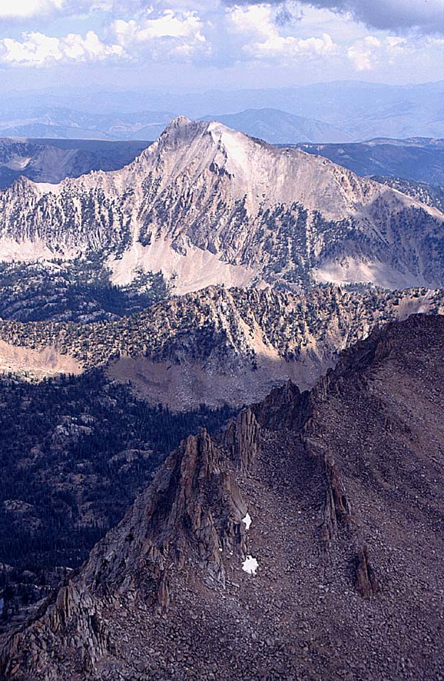
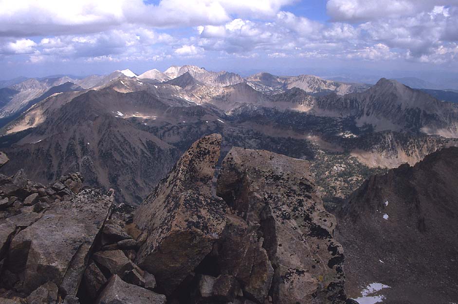
| Castle Peak - 11,815 feet Chamberlain Basin Route |
|
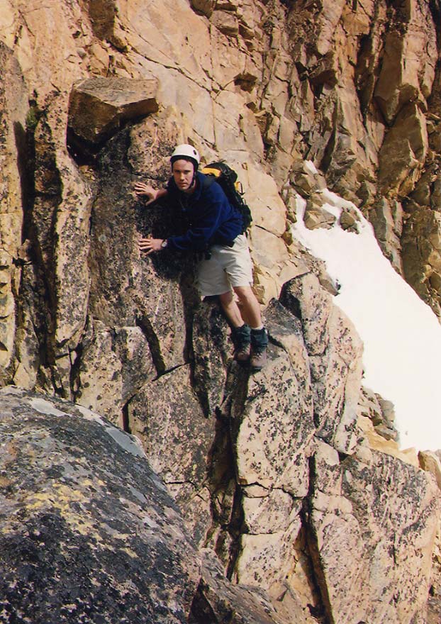
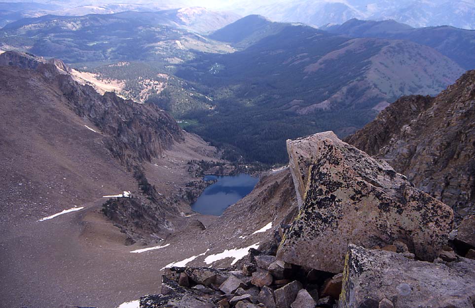
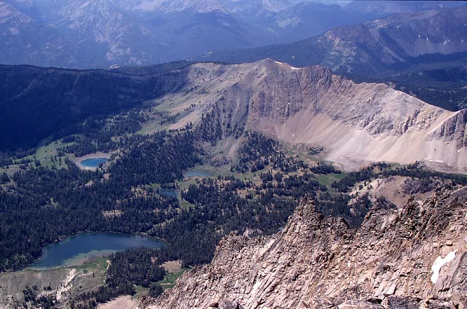
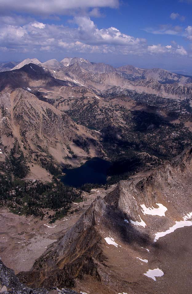
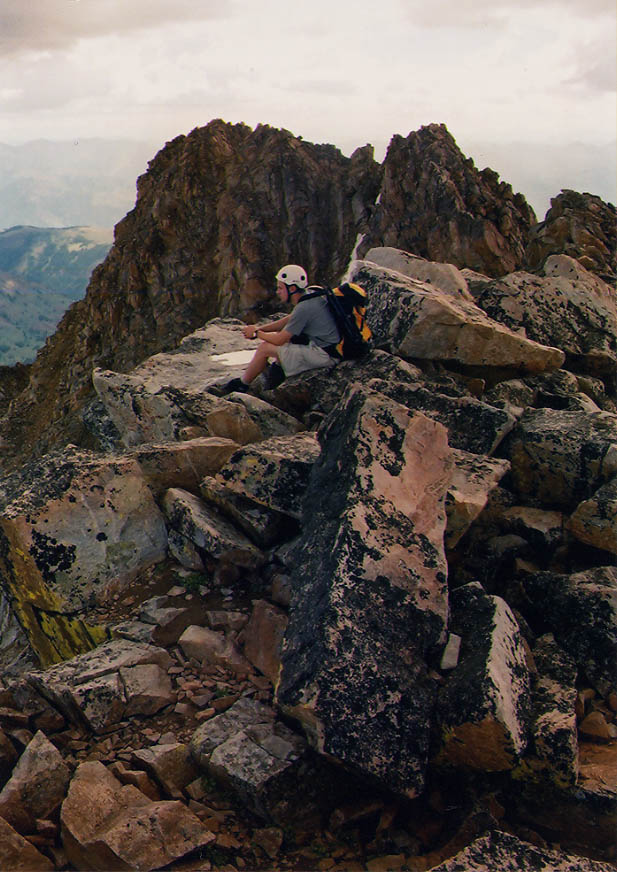
Castle's Chamberlain Basin is a class 3. All photos by Tad Schafer Castle dominates the White Clouds and is easily the most recognizable Idaho summit. Access for the Chamberlain Basin route is via the Pole Creek/Germania Creek Road (FS-197). Turn east onto Pole Valley Road 24 miles south of Stanley just after the the Smiley Creek Lodge. Follow Pole Valley Road for 2.4 miles east to the junction of Pole Creek/Germania Creek Rd. Follow this road east for 6.8 miles to Pole Creek Summit. The road becomes rough and fords the creek several times. A 4wd is recommended. Descend Pole Creek Road for 3.5 miles to its end at Three Cabins Creek. An old mining road continues from here into Washington Basin. Follow the old mining road for 1 mile until you come to a stream crossing. After the creek crossing is a small clearing off to the right and serves as good parking. Follow the Chamberlain Basin trail east. Take the left-hand fork of the first trail junction. The right-hand fork leads southeast to Germania Creek. At the next junction, take the right-hand fork to Chamberlain Basin. The left-hand fork leads to Washington Lake. The right-hand fork climbs on good tread up the hillside overlooking the Germania Creek drainage. Good views of Washington Basin to the west can be seen. The trail leaves the hill side and enters forest until it crests a summit overlooking magnificent Chamberlain Basin and grand view of Castle. Take a few pictures, soak in the view, and note the south gully that will be your access route to the summit. Descend on the trail to the first set of lakes. There are good campsites at all of the lakes, the best being at Lake 9197. This lake was surprisingly busy, so we continued up into the basin toward the upper lakes. In August we spotted a large black bear here. To climb the summit, access the large south gully at the base of the peak, just north of Lake 9197. Either continue up the gully, or mount the buttresses on either side. We chose to stay in the gully and climb out onto the western buttress when the going was too slow or loose. The large south gully narrows as you climb. Take caution to climb abreast of each other, instead of single file. This will eliminate the risk of knocking rock down onto each other. Castle is known for injured climbers that have done such. One-third of the way up, the large gully divides into 2 gullies. Take the left gully and proceed another third of the way up, transitioning from loose talus to large boulders. Find a place to leave the gully to angle right onto the face of Castle and head toward the westernmost summit of the 4. On top of the westernmost summit you can either choose to call it good, or you can traverse the other summits. We chose to traverse to summit #2 and #3 going east. The climbing, for us, was the most exhilarating part of the climb. The terrain can quickly turn into class 4. On top peer down into Chamberlain Basin to the south, Castle Lake and Serrate Ridge and the Big Gully route to the north. Further north lies the Boulder Chain Lakes, Big Boulder Lakes, and Peaks 11,202 (Granite), 11,272, DO Lee, WCP-9, Caulkens, and WCP-10. |
|||||||||||