Scout
your next climb in Idaho
|
Scout
your next climb in Idaho
|
|
| The Devil's Bedstead (East) |
|
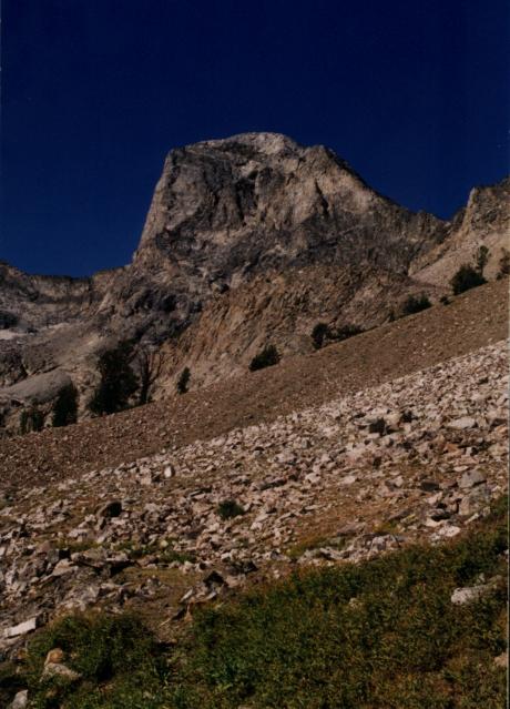
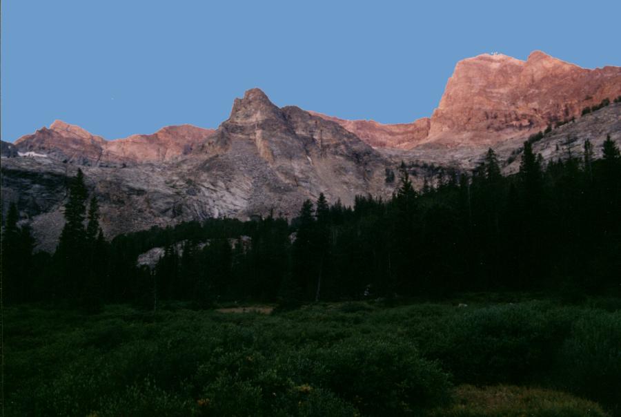
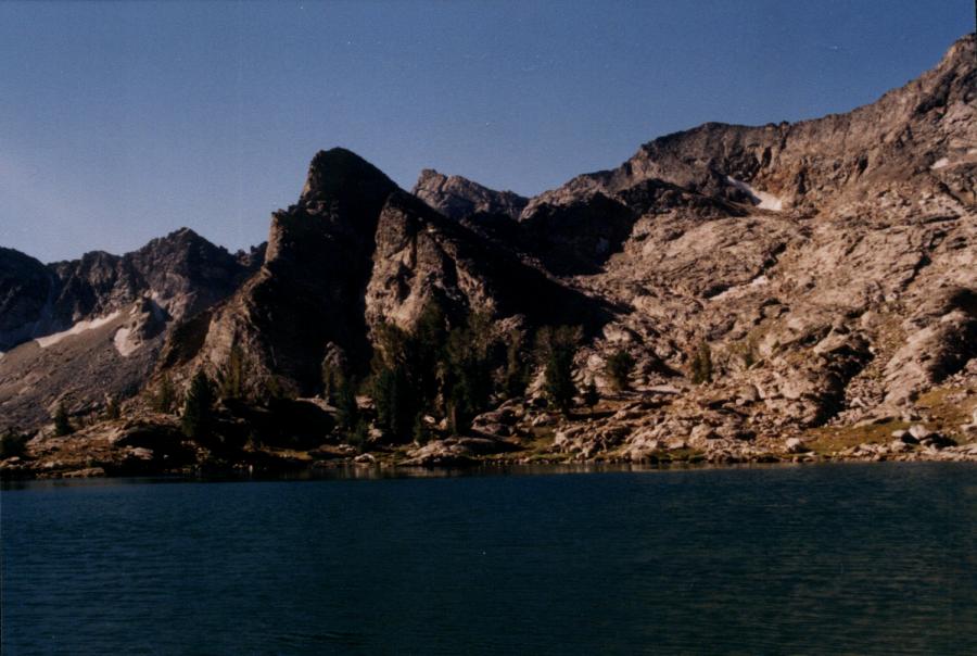
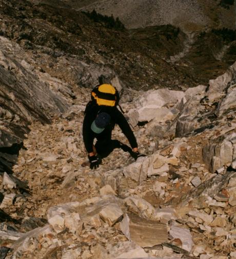
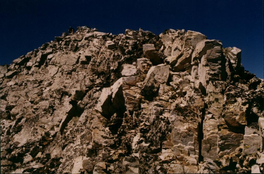
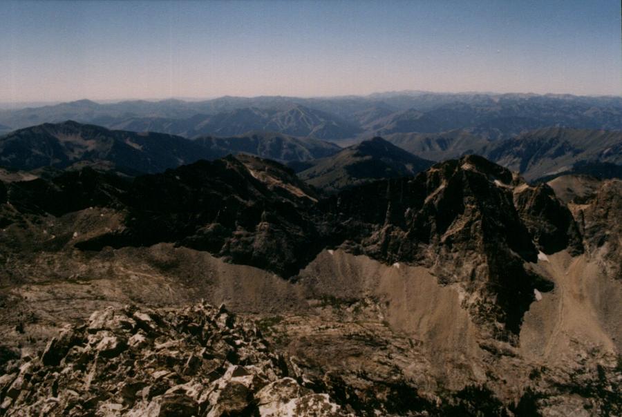
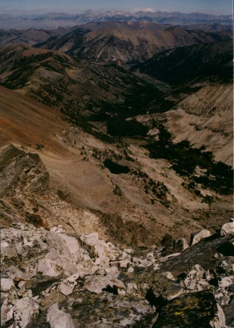
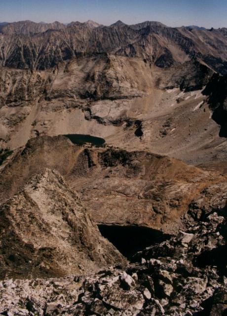
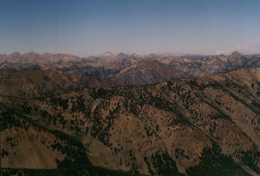
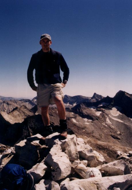
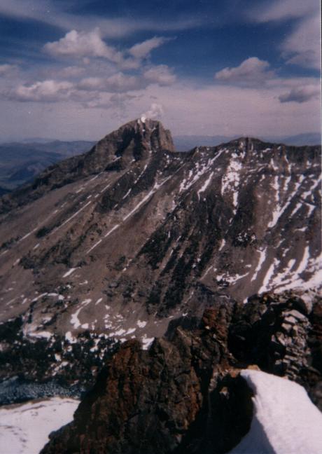
The Devil's Bedstead East sits at 11,865 feet. The rortheast ridge is a class 3-4 route while the northwest face is a class 3 route. There is some confusion as to which peak is the Devil's Bedstead, peak 11,051 to the west or 11,825 to the east. The USGS quad and the Challis National Forest maps designate peak 11,051 as the Devil's Bedstead while the Sawtooth National Forest map designates peak 11,865 as the Devil's Bedstead. Surveyors Griswold and Perkins named peak 11,865 as the Devil's Bedstead. Tom Lopez designates the shorter, west peak, as the Devil's Bedstead West and the taller, east peak as the Devil's Bedstead East. Northwest Face Photos by Tad Schafer The climb is best taken as an overnighter in the stunning Boulder Creek basin. The hike into the basin is an approximate 1,000 foot gain in elevation in 3.5 miles. To reach the trailhead, drive east on the Trail Creek Road east out of Ketchum and Sun Valley. At 22 miles turn south onto the Copper Basin Road and drive past Copper Basin Guard Station. At 2.5 miles, turn south onto the Wildhorse Canyon road and watch for views of Old Hyndman to the south and the Devil's Bedstead to the west. The trailhead to the Boulder Lake trail, FST-057, is just before Wildhorse Campground. A bridge, at one time, crossed Wildhorse creek, but is now gone. In August, you can forde the creek in your boots and gaitors. Follow the well-groomed trail up a series of switchbacks for the first half mile until you cross Boulder Creek and then climb quickly along the left bank while Boulder Creek cuts through an impressive small canyon on the right. The trail then crosses Boulder Creek again. At this point look up toward the Devil's Bedstead. A few feet from the crossing you will find a rock cairn and a faint right-hand fork to the trail. Continuing straight will lead to a beautiful large meadow and eventually Boulder Lake. Taking the right fork will climb the sagebrush slopes and take you to Washington Lake at 10,000 feet and the approach for the northern saddle and the summit of the Devil's Bedstead. You may wish to continue on another 3/4 miles to the meadow to camp overnight. Boulder Lake and additional camp sites are another 1 1/2 miles and 500 feet in elevation. To save time, it would be best to continue on to the meadow to camp overnight and then, either, return to the junction and take the right fork, or bushwack up the sagebrush and dirt slopes until the right fork of the trail is encountered, and then proceed north along the trail to Washington Lake. From Washington Lake, look west and find the saddle. You will need to pick a route up through the canyon walls that border the west side of the lake. Once above the lake, climb through the loose scree to the saddle. At the saddle, look northeast and pick out Borah and the Lost River range and look northwest to spot the Boulders, White Clouds, and Castle Peak. From the saddle, instead of following the ridge north, countour around the northwest face and choose one of the gullies. The ridge is a class 3-4 route with towers to negotiate, while the northwest face is a classic class 3 scramble. Downclimbing will take nearly as long as the ascent. Once on top, pick out the Devil's Bedstead West due west, Salzburger Spitzl to the south, twin-summited Goat Peak to the south east, and Hyndman and Old Hyndman just beyond Goat. Looking east spot Standhope Peak and Smiley Mountain. Directlly below to the south is Kane Lake. Nearing the abrupt east face edge, Boulder Lake can be seen below.
|