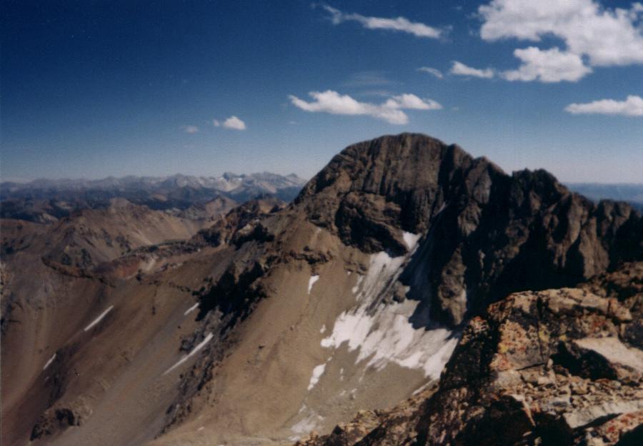
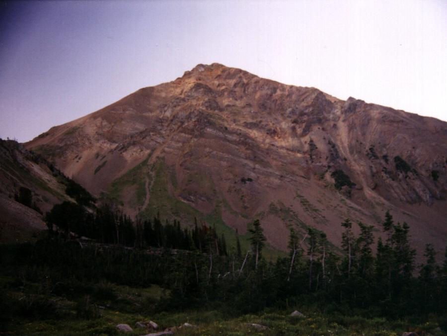
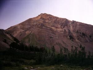
Kent Peak from Ryan Peak with the Pioneers in the background
|
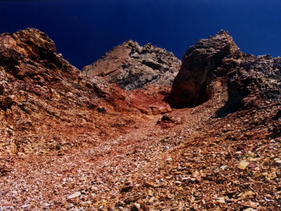
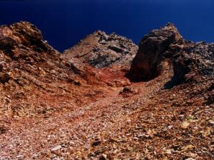
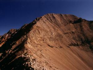 Kent Peak's south ridge
 |
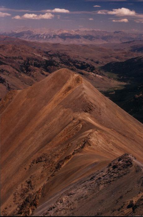
 Kent's northwest ridge connecting to Ryan
 |
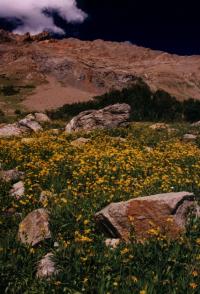
basin below Kent |

looking toward Sun Valley |

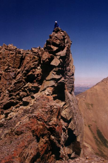
rock tower on Kent's northwest ridge |
 looking south from our campsite
 |
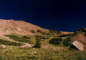 the basin below West Pass from our campsite
 |
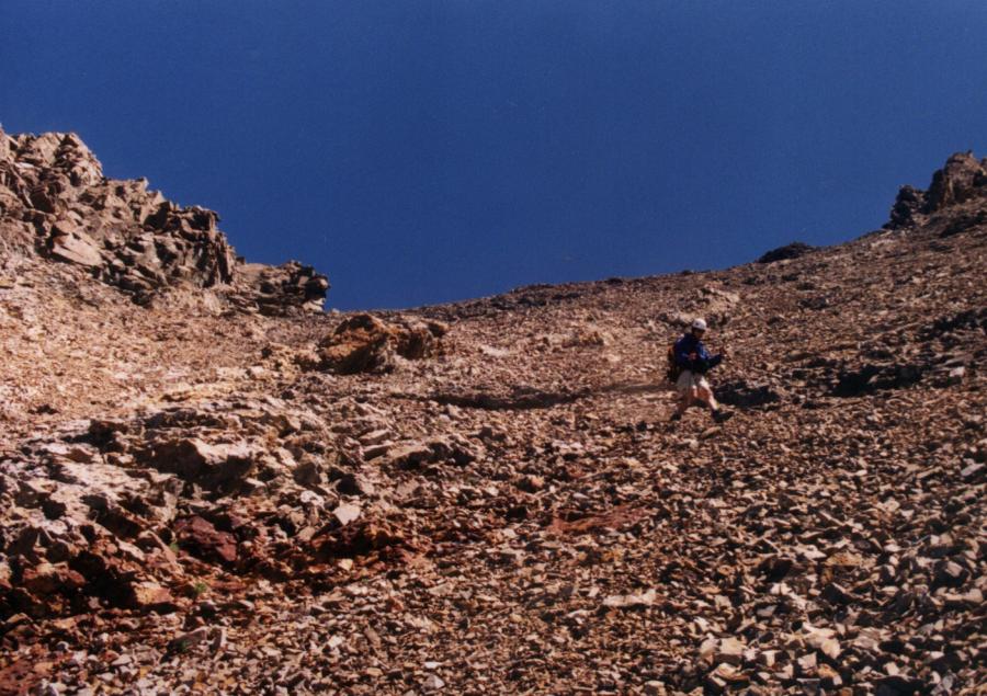
 descending a chute off Kent's northwest ridge
 |
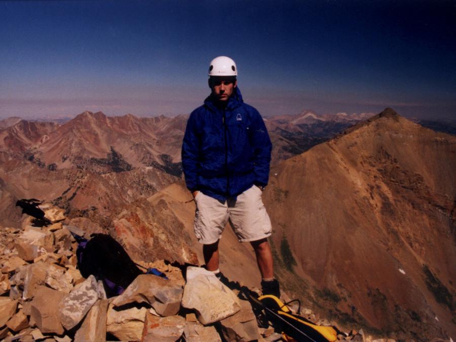
 on top of Kent Peak with Ryan Peak in the background
 |
|
Kent Peak sits at 11,664 feet. The south ridge is a class 3.
Topo of the route
South Ridge
Photos by Tad Schafer
Kent Peak's north face is a rugged site with a permanent snowfield and
bergschrund.
The South Ridge route is a class 3. Turn off of ID-75 north of Sun Valley
at the SNRA headquarters. Follow the dirt road, FS-146, for 5.5 miles
to the North Fork trailhead and a small camping area. Follow the North
Fork Trail as it begins on the right-hand side of the parking area, climbs
the hill, and then descends down along side the North Fork of the Big
Wood River. In 1.5 miles you pass the opening of a long canyon on your
right. Kent Peak can be seen at the head of the canyon. Pass the opening
of the canyon and look for the West Pass Trail on your right in a small
sagebrush clearing marked with several rock cains. The junction can be
hard to find. The trail enters thick trees in 25 yards. It then switchbacks
up a tree-covered hill and then meets up with the canyon. Watch for several
waterfalls on your right. The trail eventually leads to West Pass.
At 9,400 feet, you enter a small sloping basin with a suitable campsite
for 2 on your right. From here, leave the trail, cross the creek, and
hike up into the basin headed for the saddle between Point 11,000 and
Kent. Once to the saddle peer down into the drainage below. From here,
follow the south ridge on solid rock for an extremely enjoyable class
3 climb that goes quickly due to the solid footing.
Once on top, Ryan Peak can be seen to the north-northwest. Castle Peak
is beyond Ryan. The Pioneers are to the southeast. Traversing the ridge
to Ryan is possible and will contain route finding problems due to class
4 rock towers. Dropping into the chutes to avoid the rock towers will
lead to gentler terrain below and allow you to traverse the ridge to just
above West Pass and just below the saddle of Ryan and Kent. From the saddle
of Ryan and Kent, proceed directly up the class 2 south ridge of Ryan.
To return, drop from the saddle directly to West Pass and descend on the
trail.
How Kent Peak Got its Name
This is a story of three outdoors buddies and their adventures in the central Idaho mountains of the late 1950's. One of the buddies, Kent Lake, was called home way too early at the age of 29. What follows is how the remaining two, Bill McIntyre and Ben Shuey, achieved a lasting memorial for their fallen friend.
First, I'd like to share the information on how Kent Peak received official name recognition, and for this thanks go to Roger L. Payne, Executive Secretary, US Board on Geographic Names, for providing a copy of the Kent Peak case file. But of course there is a story behind the story, and it is Ben Shuey who gives a moving first person narrative. I quote a good portion of his memorial article "The Naming of Kent Peak" which appeared in the University of Idaho Alumni Magazine, Fall 1991.
The Application
W.A. McIntyre of Twin Falls, Idaho, made the following 'proposal of name for an unnamed domestic feature' to the US Board on Geographic Names, dated Oct 18, 1959.
Proposed name: Kent Peak
Description and extent of feature: The peak is approximately one and one half miles southeast of Ryan Peak. It's elevation is roughly 11700 feet.
Basis of knowledge that the feature is unnamed: No map has been observed where the above described peak is referred to by name. We climbed the peak on
Aug 15, 1959 and there was no written record of its having been climbed before, nor any register box on the summit.
If name commemorates a person, state full name: Kent Easton Lake
Date of person's death: March 19, 1958
Last residence: Los Angeles, Calif
Brief biography: Born in the state of Pennsylvania. A graduate of the University of Idaho Law School. Attorney in Burley, Idaho, for several years.
A rabid mountaineer.
On 12/18/59 J.O. Kilmartin, Executive Secretary of the BGN, wrote McIntyre for clarification on whether Mr Lake actually climbed the peak. McIntyre responded that Lake did not climb the peak in question, but had climbed Hyndman and Borah. On April 13, 1960 the BGN approved the name Kent Peak, thus standardizing this geographic name for use on future Federal maps and products.
Ben Shuey's story
Ben Shuey, University of Idaho class of '53, fondly remembers his friend:
"Kent and I were law school buddies at the University of Idaho in the early 1950's. After graduation I settled in Twin Falls, Idaho, and a year later Kent graduated and came to the nearby town of Burley to practice law. We became acquainted with my school teacher neighbor Bill McIntyre- an avid fisherman and mountaineer. Kent and I were badly in need of physical exercise after three sedentary years of law school, and soon the three of us were spending most of our spare time hiking and fishing.
We had trout madness... But we were young and intense.... fishing could be frustrating. As a counterpoint to fishing, mountain climbing held great appeal. Here chance was reduced to a minimum, and success or failure depended almost entirely on one's resolve and physical strength.
Bill McIntyre, always our leader in the outdoors, selected the object of our first mountain ascent: Mt Hyndman....
One would not suspect a tough, wiry little guy like Kent had any health problems. In fact, he was diabetic. Following our ascent of Mt Borah Kent's health began to decline....
It wasn't long after Kent left (for Los Angeles) that I left for Seattle. I kept in touch with Kent right up until the time of his death.... I returned (to Idaho) as often as I could to fish and climb with Bill McIntyre.
In the summer of 1958 (?) Bill suggested we climb 11900 foot Ryan Peak in the Boulder Range. We were in good physical condition and well supplied. The hike in (along North Fork Big Wood) and the ascent were uneventful. As we rested on the summit and enjoyed the panoramic view we realized something was wrong. "What could that big peak to the northwest be?" Bill asked. We triangulated our topographic map and then realized we'd made a mistake. We had climbed the wrong peak. The peak to the northwest was Ryan. We had ascended an unnamed peak of 11700 feet.
"This is probably a first ascent" Bill said. "I understand the first one to climb a peak has the right to name it". We were later to learn that such was not the case. But it seemed a good idea at the time, and we happily pondered a name for our mountain. Bill suggested our friend Kent Easton Lake and I suggested Kent Peak, as the name Lake could be geographically confusing. Bill wrote to the Department of Interior. After considerable correspondence back and forth he managed to convince the Board on Geographic Names that our late friend was worthy of the honor. The mountain was officially entered on the register of geographic names as Kent Peak."
Epilog
Given the geographic information available to them, it is understandable how McIntyre and Shuey ended up on an unintended summit. Our Idaho boys are in good company in this respect. In 1864 Clarence King and Richard Cotter while searching for California's highest peak ended up discovering the fourteener Mt Tyndall instead. All's well that ends well.
The topographic map available at the time to McIntyre and Shuey was the Hailey 30 minute quad, surveyed in 1894-5, which shows 100' contour intervals. The newly named Kent Peak appeared on the 1965 Challis National Forest map with an elevation of 11700'.
In 1967 the USGS 7.5 minute Ryan Peak topo map became available and shows Kent Peak with an unchecked spot elevation of 11664'.
The rusty coffee can I found on the summit of Kent Peak in 1994 was probably placed by McIntyre/Shuey 35 years earlier.
Information compiled by
Rick Baugher
Feb 13, 2008
|