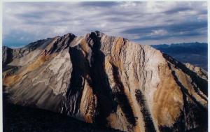
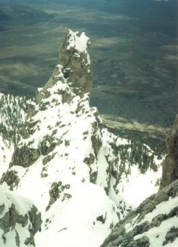
 Peak 11,308 rising above Cedar Canyon, looking south from Borah
 |
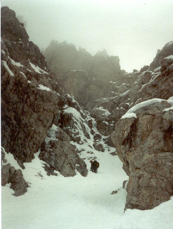
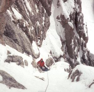
 Just below the first icy section climbing
 |
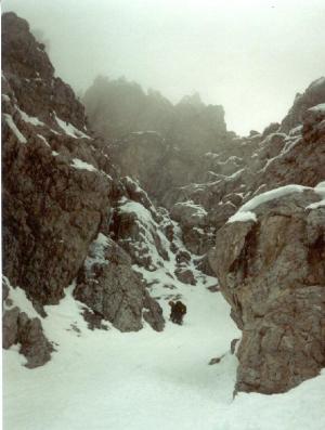
 Small snow section of couloir at mid height on the route
 |
The obvious tower as seen from above on The White Line Couloir |

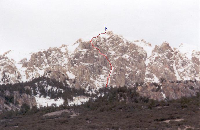
The route of the White Line Couloir. Photo by Travis Michaelis. |
|
Peak 11,308 - Lost River Range
White Line Couloir II 5.6, WI4, M5
Dean Lords, Jason Gee, 1st attempt April '95
Dean Lords, Dan Harker, Complete May '96
This Route is located on the Southwest Face of Peak 11,308, which sits
2.3 miles Southwest of Borah Peak. Finding this route could be a challenge!
The Southwest Face of Peak 11,308 is a complex series of towers, gullies,
and steep walls of rock. The White Line ascends the left most couloir
system on the Southwest Face. If one knows the routes location, the lower
section of the route can be seen from the Highway northwest of Whiskey
Springs. This technical climb requires a winter with above average snowfall
followed by a cold, wet spring. It's also possible this route could form
in the winter during certain periods following a freeze/thaw cycle.
The approach to this route is tricky. Best to find it on a map (Elkhorn
Creek) before hand. Start from just north of Whiskey Springs at the left
bend in the Highway. Drive or hike up a steep 4x4 road that ends near
the lower tree line. This road ascends the west side of the Peak. From
the end of the road, park by the fence which ascends up the hill side,
and hike along side the left edge of the fence. After some distance a
steep ravine will be encountered. Cross this ravine and continue up and
left into the next drainage. Follow this drainage into the bowl (avalanche
prone) below the southwest face. The right side of the White Line Couloir
as seen from the bowl, forms the left edge of an obvious tower.
Ascend snow slopes to the base of the couloir. The very start of the couloir
is a large rock overhang. Climb a rock chimney to the left of this overhang
for half a rope length (5.6) onto the slopes of the couloir. Strait forward
snow climbing with a few short sections of 60-degree ice (or rock slabs
depending on conditions) following the left edge of an obvious tower for
several hundred feet. At a point where one is almost even with the height
of the tower, the couloir turns left and the angle increases. The next
section of climbing involves steep ice climbing in a narrow chimney (WI4
in good conditions, or WI4, M5 in lean conditions) to a steep and narrow
section of snow in the couloir. Above this section of couloir the route
turns right up a beautiful tight chimney with a thin strip of ice down
the back. The climbing stays in a tight chimney for two more pitches of
rock, ice, and snow. Theses pitches offer excellent mixed climbing. The
top of the technical portion is marked by a huge chockstone. From this
point descend the steep gully on the opposite side to reach the open slopes
below the summit. This section of climbing from the top of the technical
portion to the summit could be very dangerous as one is ascending an avalanche
prone slope of snow.
Descent was made down a steep gully (marked by a large boulder at the
top of the gully. You will pass this on the way up the summit snowfield)
on the south side of the mountain. This route is relatively safe but avalanches
are possible in the bowl to the right of the southwest face, as well as
the upper slopes below the summit. Use extreme caution if you venture
into these bowls of snow. The technical portion of this route is safe
from avalanche hazards. We experienced very little rock fall on this route,
however facing southwest, one must expect some rock fall if the sun is
out. Best to choose a cold overcast day.
|